SDF Chatter
  • Communities
  • Create Post
  • Create Community
  • heart
    Support Lemmy
  • search
    Search
  • Login
  • Sign Up
EfreetSK@lemmy.world to Map Enthusiasts@sopuli.xyz · 1 年前

Nearest capital in Europe

vividmaps.com

message-square
48
link
fedilink
196

Nearest capital in Europe

vividmaps.com

EfreetSK@lemmy.world to Map Enthusiasts@sopuli.xyz · 1 年前
message-square
48
link
fedilink
alert-triangle
You must log in or register to comment.
  • xigoi
    link
    fedilink
    English
    arrow-up
    43
    ·
    1 年前

    For those who don’t know already, this is called a Voronoi diagram.

    • Suck_on_my_Presence@lemmy.world
      link
      fedilink
      arrow-up
      11
      ·
      1 年前

      I think I’m too stupid to understand this. How are they straight lines and not at a diameter / in a circle from any given point? It seems… wrong.

      • Ephera@lemmy.ml
        link
        fedilink
        English
        arrow-up
        37
        ·
        1 年前

        Does this animation help?

        https://upload.wikimedia.org/wikipedia/commons/thumb/d/d9/Voronoi_growth_euclidean.gif/440px-Voronoi_growth_euclidean.gif

        • Suck_on_my_Presence@lemmy.world
          link
          fedilink
          arrow-up
          12
          ·
          1 年前

          Oh! It totally does. I guess I’ve just never had to apply distances in such a way that they’d butt up against one another to become what looks like basic geometry.

          Thanks!

        • Successful_Try543@feddit.org
          link
          fedilink
          English
          arrow-up
          4
          ·
          edit-2
          1 年前

          I assume part of the confusuion is that the earth is not flat. If one would create a Voronoi diagram on the surface of a globe, the resulting borders would still be straight lines, but, when projected, it depends on the projection, whether they remain straight.

          The creator probably started with a Mercator projected map of Europe and then calculated the distance between any point on the map and all capitals. The distance on two points on the spere, however, cannot be obtained by counting the distance in h/v pixels on the map and applying Pythagoras, as Mercator projection exaggerates horizontal, east-west, distances. So one needs to map the pixel coordinates back onto the sphere and calculate the distances there.

          It’s definitely a nice map though.

      • Kusimulkku@lemm.ee
        link
        fedilink
        arrow-up
        4
        ·
        1 年前

        What does the separating line between two circles look like?

        • FreeRangeMustard@lemm.ee
          link
          fedilink
          English
          arrow-up
          5
          ·
          1 年前

          More… circles?

          • Kusimulkku@lemm.ee
            link
            fedilink
            arrow-up
            13
            ·
            edit-2
            1 年前

            I’ve tried to demonstrate it here. You end up with straight lines because it’s always a middle point so it doesn’t curve one way or another between the two points.

            If the circles had a set radius then you’d have empty space and more circley-looking spots. But since they basically expand until there’s a middle point you’ll have these straight lines.

            • FreeRangeMustard@lemm.ee
              link
              fedilink
              English
              arrow-up
              7
              ·
              1 年前

              I was joking. But +1 for the effort and this looks like art, btw.

              • Kusimulkku@lemm.ee
                link
                fedilink
                arrow-up
                6
                ·
                1 年前

                Oh dang didn’t realize you weren’t the same person. Thanks for the compliment, I had fun drawing it

          • Kusimulkku@lemm.ee
            link
            fedilink
            arrow-up
            3
            ·
            1 年前

            Draw it, then consider where the exact middle point would be. Now do the whole line between them. I think that’s the best way to figure it out.

  • OBJECTION!@lemmy.ml
    link
    fedilink
    arrow-up
    30
    ·
    1 年前

    I, for one, support the Republic of Great Ireland and Northern Britain

  • Limfjorden@feddit.dk
    link
    fedilink
    English
    arrow-up
    19
    ·
    edit-2
    1 年前

    On this map, you can see why Denmark’s capital is Copenhagen. When Denmark controlled Scania and Schleswig-Holstein, it was much more centrally located than today. The borders of Denmark in this map correspond roughly to the borders before the Treaty of Roskilde.

    • SmoothOperator@lemmy.world
      link
      fedilink
      arrow-up
      5
      arrow-down
      1
      ·
      1 年前

      Make Scania Danish Again

      • Successful_Try543@feddit.org
        link
        fedilink
        English
        arrow-up
        2
        ·
        edit-2
        1 年前

        Seconded, if Danes would take the hot potato out of their mouth and start speaking proper Swedish. :p

        • SmoothOperator@lemmy.world
          link
          fedilink
          arrow-up
          3
          ·
          1 年前

          The question is, do Scanians speak proper Swedish?

          • Successful_Try543@feddit.org
            link
            fedilink
            English
            arrow-up
            2
            ·
            1 年前

            Depends, when actually speaking Swedish only with Scanian accent, they are ok to understand, but when switching to Scanian – impossible, but in a different way than the Danes.

        • retrolasered@feddit.uk
          link
          fedilink
          English
          arrow-up
          2
          ·
          1 年前

          You either want the danes, or you want someone else who doesnt speak danish, you cant have both

    • Swedneck@discuss.tchncs.de
      link
      fedilink
      arrow-up
      4
      ·
      1 年前

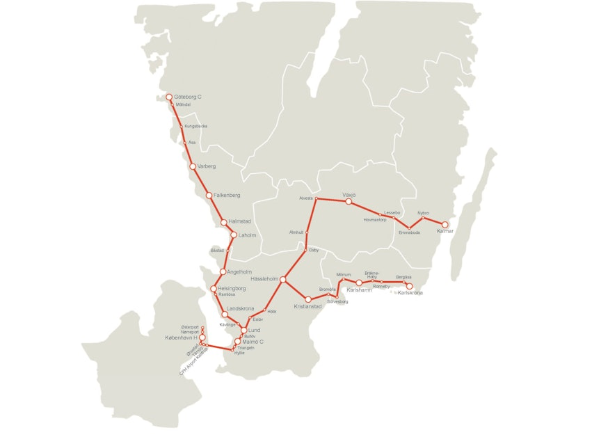
      it’s also weirdly accurate to where people might commute to copenhagen today
  • Sphks@jlai.lu
    link
    fedilink
    arrow-up
    15
    ·
    1 年前

    I think that these should not be straight lines regarding that the Earth is a sphere. Especially between Moscow and Helsinki.

    • Sphks@jlai.lu
      link
      fedilink
      arrow-up
      5
      ·
      1 年前

      https://math.univ-lyon1.fr/~alachal/diaporamas/diaporama_cartographie3/Great_Circles.htm

    • Swedneck@discuss.tchncs.de
      link
      fedilink
      arrow-up
      4
      ·
      1 年前

      it should also take into account transport feasability to at least some degree, like no one in their right mind would associate narvik with helsinki…

      • Successful_Try543@feddit.org
        link
        fedilink
        English
        arrow-up
        3
        ·
        1 年前

        For railway, there is already some neat project for visualising the reach in a certain travel time from any city with a station. https://www.chronotrains.com/de/explore

  • kluczyczka (she/her)@discuss.tchncs.de
    link
    fedilink
    English
    arrow-up
    14
    ·
    1 年前

    this i an amazingly informative rendering.

  • Ekky@sopuli.xyz
    link
    fedilink
    English
    arrow-up
    13
    ·
    1 年前

    What about Edin, bruh?

  • Jourei@lemm.ee
    link
    fedilink
    English
    arrow-up
    10
    ·
    1 年前

    As a finn, I approve these new borders.

    • Tope@sopuli.xyz
      link
      fedilink
      arrow-up
      4
      ·
      1 年前

      Suur-Suomi !

  • WolfmanEightySix@piefed.social
    link
    fedilink
    English
    arrow-up
    7
    ·
    1 年前

    I’d much rather be ruled by my closest capital.

  • bob_lemon@feddit.org
    link
    fedilink
    English
    arrow-up
    5
    ·
    1 年前

    North Macedonia

  • sem@lemmy.blahaj.zone
    link
    fedilink
    arrow-up
    4
    ·
    1 年前

    How did u make this

    • shiny_idea@aussie.zone
      link
      fedilink
      arrow-up
      3
      ·
      1 年前

      I don’t know how NaytaData made it, but if I were doing it, I would do something like this:

      • start with a “blank” un-coloured map of coastline and country borders
      • put all the “capital” cities on the map
      • make a temporary grid of points over the map and find the closest city for each point
      • paint the map based on those temporary grid points

      I would use a computer but the same steps would work with paper & pen.

      • Suck_on_my_Presence@lemmy.world
        link
        fedilink
        arrow-up
        4
        ·
        1 年前

        If the OP is using GIS, it can be even easier.

        Your first two steps are spot on, but then step three could simply be to add a large buffer for each capital and use some and/or/nor/xor (I’d have to look up to be certain) rules to have the buffer zones not overlap, but end where touching. Apply a color scheme and you’re in business.

  • PunkiBas@lemmy.world
    link
    fedilink
    arrow-up
    4
    ·
    1 年前

    There’s something funky going on north of valleta

  • BenutzterName@discuss.tchncs.de
    link
    fedilink
    arrow-up
    4
    ·
    1 年前

    Voronoistan Union

  • nevermind@lemm.ee
    link
    fedilink
    English
    arrow-up
    4
    ·
    1 年前

    Where’s Edinburgh?

    • Drew@sopuli.xyz
      link
      fedilink
      arrow-up
      4
      ·
      1 年前

      Scotland is part of the UK sadly

      • nevermind@lemm.ee
        link
        fedilink
        English
        arrow-up
        2
        arrow-down
        1
        ·
        1 年前

        Scotland is one of the four countries comprising The United Kingdom of Great Britain and Northern Ireland. The others are England, Wales and Northern Ireland. Scotland’s capital is Edinburgh.

        • snake@lemmy.world
          link
          fedilink
          arrow-up
          5
          ·
          1 年前

          I fully support Scotland independence, however at this time it is a constituent country rather than a country, there is a slight distinction.

          • nevermind@lemm.ee
            link
            fedilink
            English
            arrow-up
            2
            ·
            1 年前

            Hi, Well that’s very interesting. I learnt something today. Thank you for the link.

            For the record though I am against independence for Scotland.

  • balssh@lemm.ee
    link
    fedilink
    English
    arrow-up
    4
    ·
    1 年前

    Superb way to illustrate.

  • flx@lemmy.blahaj.zone
    link
    fedilink
    English
    arrow-up
    3
    ·
    1 年前

    what if the uk colonised europe

    • smeg@feddit.uk
      link
      fedilink
      English
      arrow-up
      3
      ·
      1 年前

      Those borders don’t even line up with longitude and latitude! What is this, amateur hour‽

Map Enthusiasts@sopuli.xyz

map_enthusiasts@sopuli.xyz

Subscribe from Remote Instance

Create a post
You are not logged in. However you can subscribe from another Fediverse account, for example Lemmy or Mastodon. To do this, paste the following into the search field of your instance: !map_enthusiasts@sopuli.xyz

For the map enthused!

Rules:

  • post relevant content: interesting, informative, and/or pretty maps

  • be nice

Visibility: Public
globe

This community can be federated to other instances and be posted/commented in by their users.

  • 68 users / day
  • 680 users / week
  • 1.44K users / month
  • 2.61K users / 6 months
  • 39 local subscribers
  • 6.34K subscribers
  • 553 Posts
  • 8.87K Comments
  • Modlog
  • mods:
  • zksmk@sopuli.xyz
  • garfaagel@sh.itjust.works
  • BE: 0.19.20
  • Modlog
  • Instances
  • Docs
  • Code
  • join-lemmy.org